ΠΑΝΕΜΟΡΦΗ ΠΟΛΗ ΤΗΣ ΚΑΒΑΛΑΣ
Γενικά & Ιστορικά Στοιχεία:
 Η ιστορία της πόλης αρχίζει από τον 7ο π.Χ. αιώνα με το όνομα Νεάπολις σαν αποικία των Θασίων. Αργότερα, σαν επίνειο της πόλης των Φιλίππων ακμάζει κατά τους χρόνους του Μακεδονικού κράτους του Φιλίππου Β, πατέρα του Μ.Αλεξάνδρου. Τον 8ο αι. είναι γνωστή με το όνομα Χριστούπολις και μετά από έντονες περιπέτειες και αγώνες την εποχή των Σταυροφοριών, εμφανίζεται πάλι γύρω στο 1500μ.Χ. με το σημερινό της όνομα και εξελίσσεται γρήγορα σε σημαντικό λιμάνι, ιδιαίτερα μετά την Μικρασιατική καταστροφή.
Ο 20ος αιώνας βρίσκει την Καβάλα στην χρυσή της εποχή. Από το 1903 μέχρι το 1909 οι Έλληνες κάτοικοι, με υψηλό εθνικό φρόνημα, παίρνουν μέρος στον Μακεδονικό αγώνα. Η άνθηση του καπνεμπορίου και η αύξηση του πληθυσμού έχουν σαν αποτέλεσμα την δημιουργία πλατιάς εργατικής τάξης που οργανώνεται σε ισχυρά εργατικά σωματεία διεκδικώντας δυναμικά τα αιτήματά της.
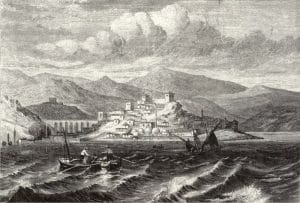
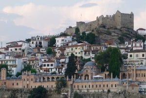
Η Καβάλα σήμερα είναι μια από τις μεγαλύτερες (περίπου 80000 κάτοικοι), μετά την Θεσσαλονίκη, πόλεις της Βόρειας Ελλάδας. Είναι κτισμένη αμφιθεατρικά στις πλαγιές της οροσειράς «Σύμβολο».
Είναι η πόλη που πολλοί την κατατάσουν ανάμεσα στις ομορφότερες και γραφικότερες της χώρας μας εξαιτίας της μοναδικής της φυσιογνωμίας, της προνομιακής τοποθεσίας στην οποία χτίστηκε αλλά και της ζεστής και φιλικής της ατμόσφαιρας.
Όπου και αν βρίσκεστε η Καβάλα είναι σίγουρα κοντά σας, καθώς συνδέεται με όλη την Ελλάδα με καθημερινή χερσαία, εναέρια και θαλάσσια συγκοινωνία και με την Ευρώπη με πτήσεις charter.
Γεωγραφική Θέση:
 Ο νομός Καβάλας βρίσκεται ανάμεσα στους ποταμούς Νέστο και Στρυμόνα, οι οποίοι αποτελούν και τα φυσικά όριά του.Η θέση του αυτή, δίπλα στη θάλασσα και πάνω στη διαδρομή που ένωνε την Ανατολή με τη Δύση, την καθιστά κομβικό σημείο επικοινωνίας λαών και πολιτισμών. Έχει έκταση 2.109 τ. χλμ. και συνορεύει με τους νομούς Ξάνθης (ανατολικά), Δράμας (βόρεια) και Σερρών (δυτικά). Διοικητικά περιλαμβάνει τέσσερις δήμους (Καβάλας, Νέστου, Παγγαίου, Θάσου). Ο νέος Δήμος Καβάλας που δημιουργήθηκε (βάσει του Νόμου Καλλικράτη) κατόπιν της συνένωσης του με τον Δήμο Φιλίππων κατέχει έκταση 344.357 στρεμμάτων. Η Καβάλα, πρωτεύουσα του νομού, βρίσκεται πάνω στην πορεία της Εγνατίας Οδού και απέχει οδικά δυο ώρες από την Θεσσαλονίκη (160 χλμ.).
Μπαίνοντας κανείς στην πόλη, την αντικρίζει ξαπλωμένη αμφιθεατρικά ανάμεσα στις πλαγιές των λόφων που την περιβάλλουν και την βόρεια ακτή του Αιγαίου πελάγους.
